


Four new hiking trails in the Ruhr area prove that outdoor enthusiasts from the area don’t have to drive miles away to stretch their legs. Find out what the new “Urban.Trails” are all about.
Urban Trails? What are They?
Germany is a nation of hikers. This hobby brings together people from all walks of life, and aside from a good pair of shoes or boots, no special equipment is needed. All that’s left is to find a good hiking trail. For city dwellers, that can sometimes mean a train ride of several hours out of the city.
Not so in the Ruhr area. Thanks to the “Urban.Trails”, there are now four urban hiking trails right in the heart of the metropolitan area: in Dortmund, Mülheim an der Ruhr, Oberhausen, and Hagen. By 2028, the number is set to rise to 15 routes. With lengths ranging from seven to 15 kilometers, they’re quite manageable for most people, though they can also be shortened at any time. Thanks to their inner-city locations, hikers are never far from a bus or train stop.

What do the “Urban.Trails” City Hiking Trails in the Ruhr Area Have to Offer?
If you’re thinking: Boring, I already know the Ruhr area. Don’t worry. Because the routes don’t pass by the “usual” sights, but instead explore lesser-known corners of the metropolitan region. Past colorful street art and mysterious abandoned places. And always near fantastic food spots. After all, no one likes to hike on an empty stomach. And there’s much more to see than just concrete, because the Ruhr area is actually quite green.
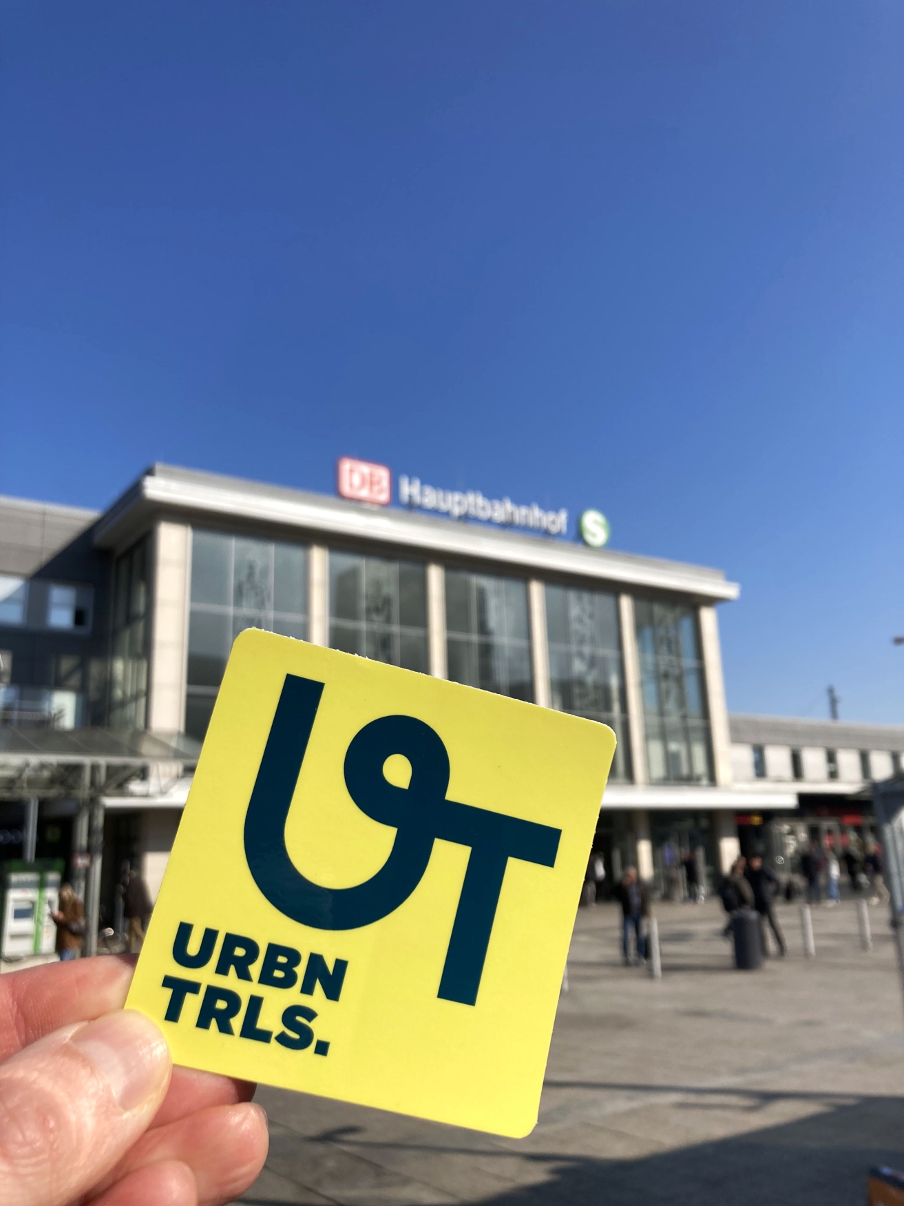
Speaking of “green”: that’s also what the trail’s logo looks like. A green “UT” on a yellow background. Marking the trails began in late March. Over time, the sign will be installed at all major trail intersections. At the start of each trail, hikers will also find a location portal with information on the route, distances, and highlights along the way. The routes are also available via Komoot and similar services.
An Overview of the Four “Urban.Trails” City Hiking Trails
But now to the essentials: These are the four city hiking trails in the Ruhr area that have been marked so far.
The “Sub.Kultur” City Hike in Dortmund
Spanning a good 14 kilometers, this hiking trail in Dortmund leads through the creative, urban side of the largest city in the Ruhr area. From the main train station, the route passes the German Football Museum and then heads toward the “Dortmunder U”. Along the way, a magnificent mural by “The London Police” awaits at Königswall.

At the “Dortmunder U” creative and cultural center, the city’s secret landmark, the “Hall of Fame” is the perfect spot for a short break. The ever-changing graffiti gallery is ideal for photos and selfies. In the Unionviertel and Kreuzviertel neighborhoods, you can also extend the walk with a stroll through the small shops and boutiques.
Passing through the harbor and several allotment gardens, the tour then leads through the greenery of Fredenbaum Park, past the Natural History Museum through the Nordstadt district, and finally back to the main train station.
👉 A detailed description of the route is available here on the Ruhr Tourismus website.
The “Erlebnis.Pfad” City Hike Through Oberhausen
Hiking enthusiasts in Oberhausen can look forward to plenty of industrial heritage and lush greenery. Along the trail’s 11 kilometers, the Ruhr area shows itself at its best. Starting at the main train station, the route first takes you through Grillopark and past Oberhausen City Hall, a prime example of German “brick expressionism.” Fancy a quick coffee break? Then head to “Zaza’s Espressobar” or “Oli’s Büdchen.”
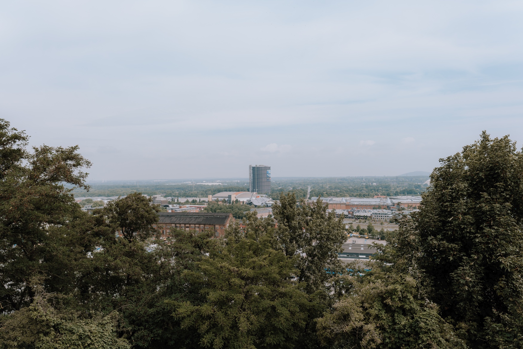
Beyond Brücktorpark, the city’s dense urban landscape gradually gives way to greenery. Passing through community gardens and along nature trails, the path leads up to the Knappenhalde, an artificial hill made of mining slag, where the vast expanse of the Ruhr area opens up. From here, you can see the CentrO shopping center, the Gasometer, and even the Haniel slag heap in the direction of Bottrop. The trail continues along an old railroad track—a reminder of the region’s industrial past—to Haus Riphorst on the Rhine-Herne Canal.
Passing the canal bridge and the “Sorcerer’s Apprentice”—a dancing power pole—the route finally leads to the Oberhausen Marina and north across the canal via the “Tausendfüßlerbrücke.” With a prime view of the Gasometer. After crossing Olga Park, the tour’s destination is the Eisenheim settlement, a 19th-century workers’ housing estate.
👉 A detailed description of the route is available here on the Ruhr Tourismus website.

The “Hike.Seeing” City Hike in Hagen
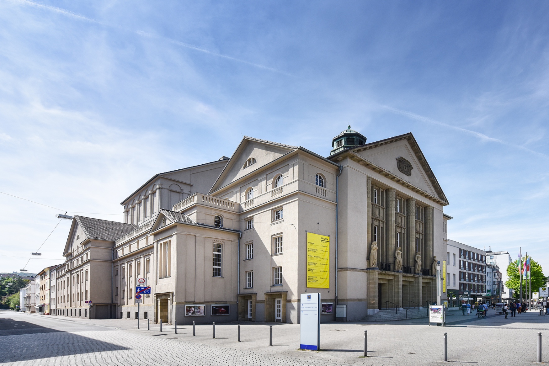
Many consider Hagen the gateway to the low mountain range Sauerland, and this becomes quickly apparent on this tour. Over the course of the roughly ten-kilometer route, you’ll climb several hundred meters in elevation. The hike starts at the main train station, heading along Bahnhofstraße and Neumarktstraße to the Hagen Theater. Passing an old bunker and through an underpass, the first green highlight of the route is Hagen City Park.
Now comes the first ascent. Passing through several allotment gardens, the route first heads toward Bismarck Tower and then continues through the forest to the Eugen Richter Tower. It’s open on weekends, offering a first-class view of Hagen and the Ruhr Valley. Then the trail leads downhill again, past the disused Klutert stadium, into the creative district of Wehringhausen.

In this bustling corner of Hagen, you’ll find murals by artist Martin Bender, as well as the creative quarter “WirrWarr.” A well-deserved refreshment is served at “Café & Bistro Gegenüber” or “Zum Buntspecht,” and if you’d like, you can pick up a small souvenir at the concept store “Onkel Jo sein Laden.” Either way, this excursion into urban greenery will stay with you.
👉 A detailed description of the route is available here on the Ruhr Tourism website.
The “Kul.Tour” City Walk Through Mülheim an der Ruhr
At twelve kilometers, the trail through Mülheim is almost a leisurely stroll through the city. The starting point here is also the main train station, from where the route first leads through the city and past several cafés offering an espresso for the energy you’ll need. Once you reach the Ruhr, however, the landscape opens up, offering a view of the glistening water surface of the river that gives the region its name.
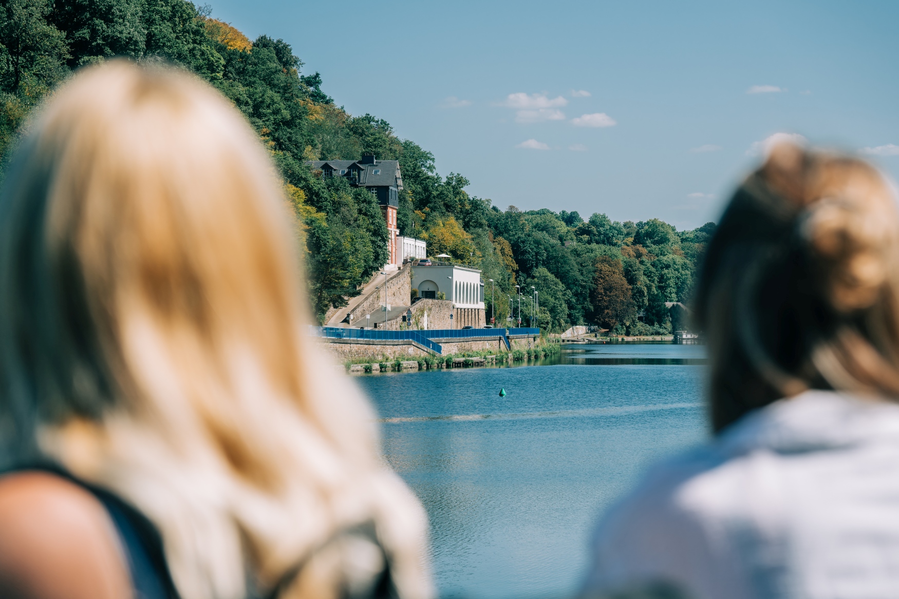
On the other side of the Ruhr, Broich Castle awaits as a historical highlight. Parts of the fortification date back to the 9th century, so it’s been around for quite a while. Not quite as old, but no less fascinating, is the Camera Obscura, which is also along the way. If you have the time, you should learn about the history of photography and film at the museum there and enjoy a very special view of the Ruhr area through the world’s largest pinhole camera.
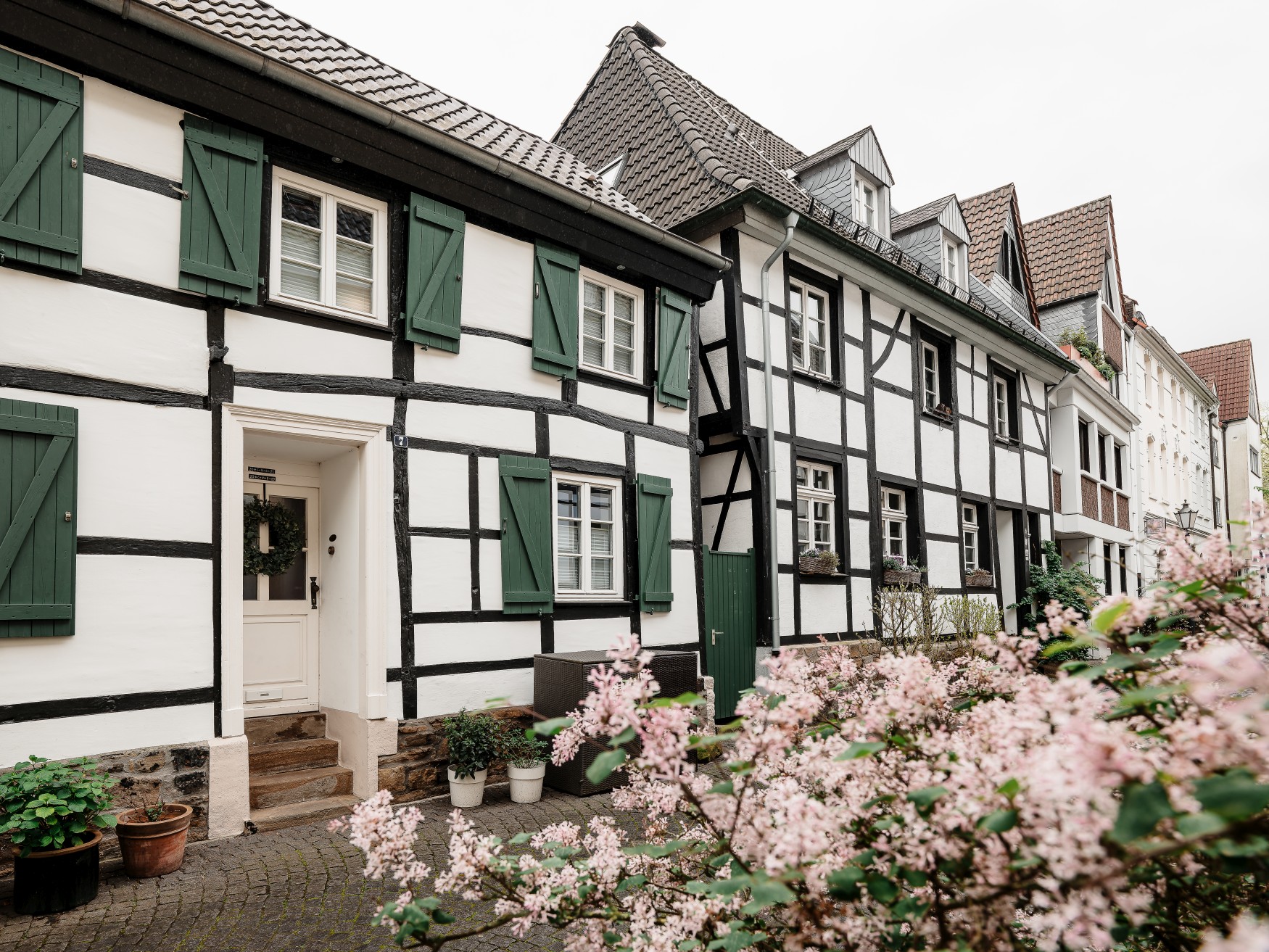
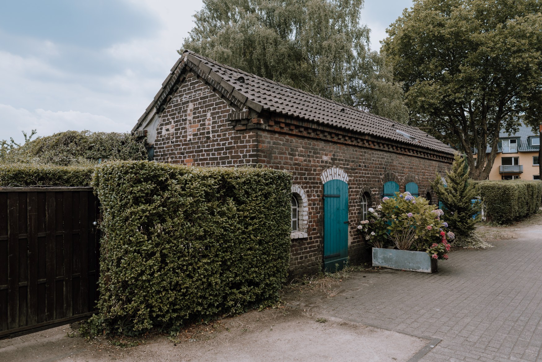
Heading south along the Ruhr, the route then leads to the village of Saarn with its monastery of the same name. Those in need of peace and quiet will find it in the monastery garden. Those looking for a souvenir will find one in the monastery shop. So there’s something for everyone. Back across the Ruhr, the route passes traditional half-timbered houses in the Wallviertel district and finally returns to the main train station.
👉 A detailed description of the route is available here on the Ruhr Tourism website.
Everything you Need to Know About the “Urban.Trails” Hiking Trails in the Ruhr Area
🥾 What? City walks “Urban.Trails” in the Ruhr area
📍 Where? In Dortmund, Hagen, Mülheim, and Oberhausen
🗺️ How many? Four routes between seven and 15 kilometers, with more planned
🪧 Trail markers? Green “UT” on a yellow background
🌐 Click here for an overview on the Ruhr Tourism website.